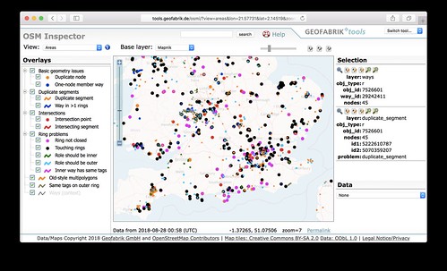
Just thought I would re-iterate something imagico blogged about. Some important features may have disappeared from the map near you. You should check! Use the OSMInspector “Areas” view:
Generally the pink things are more serious data bugs on there I think, and they’re worth fixing because it could be a big building, or local park, or some other important feature which may have recently disappeared. This is due to a change in the renderer. It’s an improvement, but it means it is being more strict about these data bugs, so we need to fix them! (Yes we’re fixing for the renderer, but these were worth fixing before because other systems will always have struggled with this data)
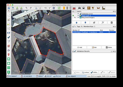
But these bugs generally involve the dreaded multipolygon relations, which are not the easiest thing to get your head around. I took a look just now and found quite a variety of different problems. Some fairly easy (e.g. this one just needed an “inner” way joining up properly to make the whole building re-appear)
…some not so easy. Problematic relations can be overlapped by other ways. Sometimes the multipolygon isn’t necessary at all (created by mistake perhaps). In that case we should take the chance to convert it to a simple closed way, to make life easier for everyone …but that can be a fiddly process in itself.
So I’m inclined to say we need to pro-mappers to attack this task. But being “pro” is all relative. Most mappers are probably like me. I’ll happily wade in and try to tackle such things up to a point, but then sometimes I hit such a tangle of data, I just throw up my hands and think to myself “either somebody has thought carefully about this data, and there’s a reason it’s like this, or somebody’s made a mess, or maybe both… but I can’t tell” at which point I’m quite happy to leave it and move on to find an easier bug to fix.
So get stuck in! There’s quite a lot to fix:
I wonder if there’s a way of knowing where the BIGGEST multipolygon bugs are.

