
In a comment on their recent diary entry publicerination suggested that use of leisure=pitch with sport=tennis was always intended for single tennis courts. I had my doubts given that someone in San Francisco was adding quantity, and I have added pitch:count and there is also a documented tag courts. Were we just the odd mappers out?

A relatively quick way to answer this was looking at tennis courts in the UK as I have a 1-2 year old import available for Great Britain. Overpass can also be used to collect the data, but it’s not possible to calculate areas directly. I ran a query which pulled tags, the geometry and the area of each pitch in square metres and saved this first as geojson and then as a csv file.
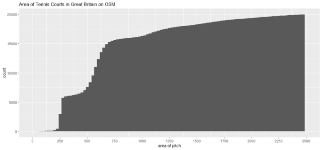
I then used R to build a simple histogram of counts of pitches in binned by increments of area of 25 sq. m. A tennis court is about 250 sq. m so this should show peaks at increments of this value. I also created a cumulative version of the histogram. Note these cutoff extreme outlying values most of which have been subsequently removed by edits by Dave F.
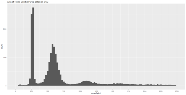
The simple answer to the query posed by the title is NO! Only about a quarter of tennis pitches represent a single court, with at least as many objects representing 2 courts and a similar number more than 2 courts. Whereas the first peak is tight, suggesting that single courts are mapped according to the visible court markings, the second peak is much more diffuse suggesting that these are mapped to the extent of the playable area (usually a wire fence). A tiny proportion (about 100 out of 20,000) have one of the tags indicating how many courts are represented by each area.
At least in the UK, tennis courts tend to be mapped together, and the data is not suitable for counting the number of courts. It is, however, suitable for finding places to play tennis which, from a conversation with the original author of Map at the weekend, was very much an original goal (albeit swimming pools in his case).
I’m all for using OSM for this type of analytical purpose, but it is important to look at how the data is structured rather than take a pure, and often personal, view of how it should be structured.
Coda: For some reason tennis courts has always posed issues as to how to map them: single courts or in groups; the in-play area within the tramlines, or the entire playing surface, etc.