On, Friday 3rd Nov 2023 at 11:47 PM NPT midnight a strong earthquake struck the western area of Jajarkot,Nepal with witnesses saying houses in the area collapsed causing several deaths and damaged. The shock was experienced as far as New Delhi, India, shook. 154 confirmed deaths and 364 injuries are reported by the National Disaster Risk Reduction and Management Authority(NDRRMA). The epicentre lies in Karnali Province, Nepal. 26,557 houses are completely damaged whereas 35,455 houses are partially damaged.
Nepal’s National Seismological Centre said the quake was a magnitude 6.4 but the German Research Centre for Geosciences (GFZ) later downgraded the magnitude to 5.7 and the U.S. Geological Survey pegged it as a magnitude 5.6. Earthquakes have been going on continuously for some time now, with the epicenter in different places of western Nepal. Geologists say that there has not been a big earthquake for a long time, so there is a lot of seismic energy.
To summarize the major activities that we have undertaken after the Jajarkot Earthquake 2023:
-
Immediately after the earthquake all OSM communities and organizations from Nepal gathered for a call and planned to mobilize on field and discussed for remote mapping.
-
The organization like Mapbuds, OSM Nepal, Kathmandu Living Labs, Nepal Geomatics Engineering Society, Geomatics Engineering Society, Geomatics Engineering Student Association Nepal, Youthmappers and Open Mapping Hub Asia Pacific collaborated to carry out the necessary activities led by Rabi Shrestha from Mapbuds.
- Phase I: included remote mapping the access roads and residential area on Jajarkot and West Rukum district.
 Fig 1: Project released for remote mapping
 - Few volunteers from Youthmappers led by the Youthmappers ambassador for Nepal were mobilized to field, Jajarkot.

- Fig 2: Update from field volunteers where many buildings were completely destroyed and aid which includes food and tents were being distributed*
-
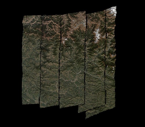
We requested post-earthquake imagery from Maxar and after a week later we got the raw satellite images which were processed by HOTOSM volunteers across the globe. And it was uploaded on OpenAerialMap and mosaiced using Kontur by Rabi who was coordinating for the imagery and remote mapping since day 1. All thanks to everyone for their helping hands specially Maxar and @Batuhan.
 Fig 3: Maxar imagery uploaded via OpenAerialMap
 -
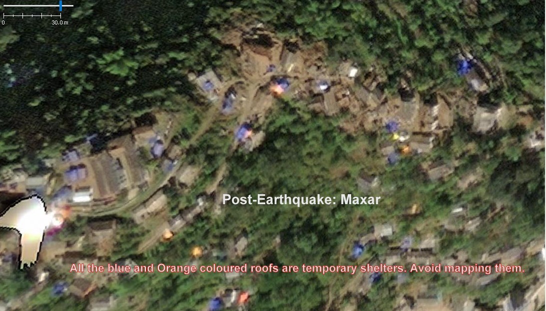
Although the Maxar imagery was claimed to be of 31 cm resolution, it is very difficult to distinguish the damaged buildings and temporary settlements. This imagery also contains an offset.
- All the remote mapping, task creation and leading remote activities were also led by Rabi from Mapbuds and their progress status is:
Jajarkot district: 66% mapped, 24% validated | West Rukum: 62% mapped, 31% validated | Post earthquake: Jajarkot: 8% mapped, 2% validated(As of 2023-11-20)
Links to HOTOSM Project:
While reviewing and mapping these OSM projects, because of the post-earthquake imagery, mapping is not taking proper shape. And the objective of mapping building footprint along with their status using apt OSM tags is lagging because of imagery resolution, offsets, mosaicing issues, and level of zoom to these imagery.
So if there are any imagery providers or donors we are grateful to coordinate and carry out this post-earthquake mapping and using the so generated data in field.
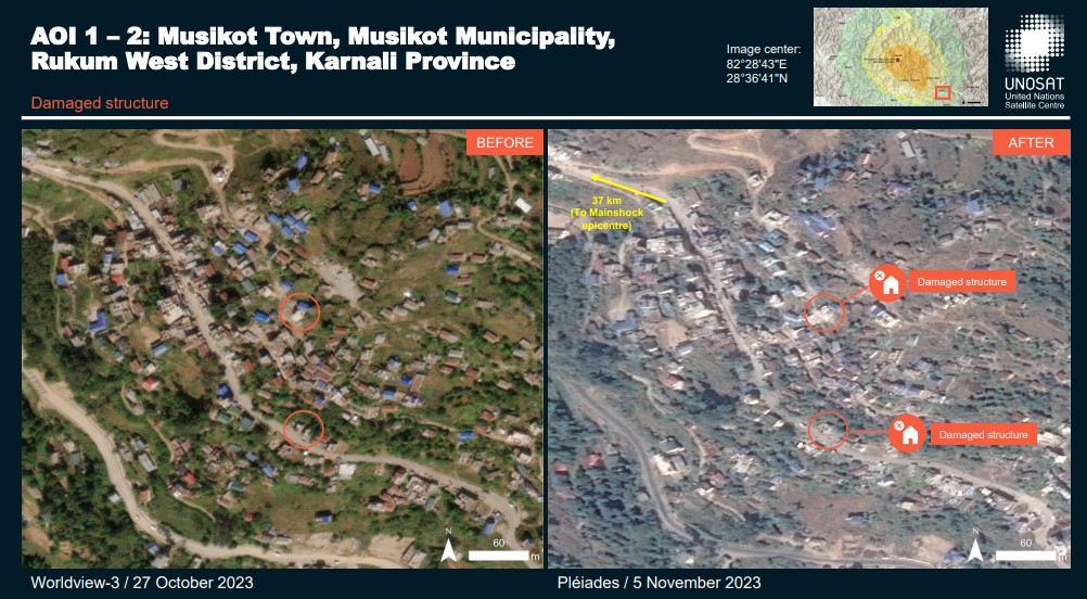
Comparative analysis between pre and post earthquake- damage assessment

