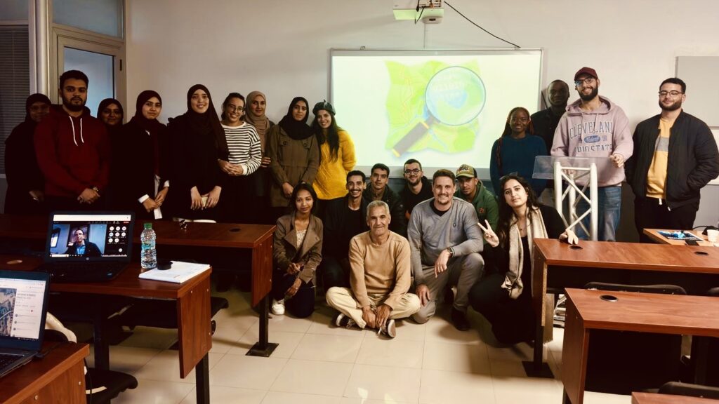
OSM training course and Mapathon in support of the victims of the 8 September earthquake in the High Atlas, Morocco [] | © SIGE – Société d’Ingénierie Géomatique et Environnementale
Mapping
- The proposal highway=cyclist_waiting_aid, to map street furniture and devices for cyclists that are intended to make waiting more comfortable, was approved with 26 votes for, 0 votes against, and 0 abstentions.
Community
- Karlos argued the importance of separating OpenStreetMap for end-users (map users) from power-users (map developers). Mweper added that this separation has been quite successful in the Android (end-user) and Linux (power-user) ecosystems.
- MapAmore tooted that custom emojis for OpenStreetMap are available on the Mastodon instance en.osm.town. The list is impressive.
- Miguel Sevilla-Callejo, from the Spanish OpenStreetMap community, is collecting data to assess the importance of OpenStreetMap as a source of spatial data in quantitative terms.
- Raquel Dezidério Souto, from Brazil, was selected as the UN Mapper of the month for November 2023.
Imports
- Martijn van Exel has devised a MapRoulette challenge to improve the historic mine data imported from the GNIS database.
Local chapter news
- Frederik Ramm has proposed closing the talk-de mailing list.
Events
- The OpenStreetMap community of Colombia and TomTom recently organised a face-to-face event in Medellin with the purpose of improving the city map by adding missing buildings through a number of MapRoulette challenges.
- Ivy Perez, a Viscan YouthMapper, visited Pista ng Mapa 2023 in Tacloban City and blogged her impressions of the event.
Humanitarian OSM
- [1] Sige published a photo-summary of the OSM training course and Mapathon, held to support the victims of the 8 September earthquake in the High Atlas, attended by 230 Moroccan students in geomatics. This action is part of the cartographic support for Morocco in response to the earthquake for which Sige is actively looking for sponsors.
Maps
- The 30DayMapChallenge 2023 on Mastodon, LinkedIn, X, and BlueSky continued.It is not possible to adequately acknowledge the multitude of outstanding works. The selection we make is purely random and not an evaluation. Please take a look at the works yourself. The hashtag #30DayMapChallenge will help you.
- Day 20: Outdoors
- Day 21: Raster
- Day 22: North is not always up
- Day 23: 3D
- Day 24: Black and white
- Day 25: Antarctica
- Day 26: Minimal
- Christopher Beddow has written an article discussing the trend towards decentralisation in local mobile map apps around the world.
OSM in action
- The Find My District feature on the New York City Council website displays a CARTO basemap of New York, which is based on data from OpenStreetMap. Guillaume Rischard has reminded the website’s development team of the need to follow OpenStreetMap’s attribution rules properly.
Licences
- Kathleen Lu, from the OpenStreetMap Foundation Legal/License Working Group, suggested that the EU member governments release their open data under a CC-0 licence rather than CC-BY-4.0, so that it can be used by OpenStreetMap. If this is not possible, they have proposed a slight modification to the CC-BY-4.0 licence to make it compatible with OpenStreetMap’s licence.
Software
- The next version of SMASH (formerly known as Geopaparazzi), yet unreleased, will support GeoJSON layers, and fix the long-standing bug that caused OSM tiles to not be visible at very high zoom levels.
Programming
- rtnf showed how to search for active OSM contributors around an area, including their edit count, and frequently used tags.
Releases
- GDAL 3.8.0 has introduced significant speed-ups in the creation of GeoPackage files (can be 3 to 4 times faster). Instead of delegating the spatial RTree creation to SQLite, as was done before, the GDAL codebase now embeds a specialised algorithm. The developer has proposed the improvements in the algorithm to the SQLite project.
- Christoph Hormann announced the release of OpenStreetMap Carto version 5.8.0.
- The November update of Organic Maps (an OSM-based mobile application) has been released, with an outdoor style preview, fixes in map styles and routing, and updated map data. Organic Maps now also has a referral link to a travel metasearch engine, which some users think conflicts with the privacy-focus mantra of the app. F-Droid has discussed adding an Anti-Features warning for users.
Did you know …
- … that you can create a StreetComplete quest icon ball animation screensaver using fallingQuestsScreensaver?
- … TomTom will be a financial backer of MapRoulette? See the OSM US’s website for details.
- … the amazingly comprehensive OSM Apps Catalog? It is a web app for filtering and searching OSM apps that are described in the OpenStreetMap wiki.
Note:
If you like to see your event here, please put it into the OSM calendar. Only data which is there, will appear in weeklyOSM.
This weeklyOSM was produced by Leonardo Gutierrez, MatthiasMatthias, TheSwavu, YoViajo, barefootstache, derFred, isoipsa, rtnf.
We welcome link suggestions for the next issue via this form and look forward to your contributions.